NYC Marathon 2026 — Verrazano Bridge Closures, Start Line & Spectator Guide
The TCS New York City Marathon is run on Sunday, November 1, 2026, and the Verrazzano-Narrows Bridge — the only direct Staten Island–Brooklyn crossing — is closed to all vehicle traffic for most of the day. If you plan to cross the bridge that Sunday, or want to watch the race from the Start Line or the bridge approaches, this guide has the closure schedule, detours, bus reroutes, and the best spectator vantage points, all sourced from MTA Bridges and Tunnels and NYRR.
🚨 Race-Day Closure: Sunday, November 1, 2026
The Verrazzano-Narrows Bridge is closed to ALL vehicles on race day. The upper level closes first (from 11:00 PM the night before, Saturday October 31), and the lower level closes at 6:30 AM on race day. The bridge does not reopen to traffic until approximately 3:00 PM Sunday. There is no way to drive across the bridge between those times — the only direct route between Staten Island and Brooklyn is completely shut. Plan your detour via the Goethals Bridge or the Outerbridge Crossing, and budget far more travel time than usual.
📅 Marathon Day Closure Schedule (Nov 1, 2026)
These are the published closure windows from MTA Bridges and Tunnels and NYRR. Closure times can shift as race logistics finalize — always confirm on mta.info/agency/bridges-and-tunnels in the week before the race.
| Time | What Closes | Status |
|---|---|---|
| Sat, Oct 31 · 11:00 PM | Upper level (both directions) | Closed to all vehicles |
| Sun, Nov 1 · 6:30 AM | Lower level (both directions) | Closed to all vehicles |
| Sun, Nov 1 · ~7:00 AM | Entire bridge | Fully closed; race operations active |
| Sun, Nov 1 · ~3:00 PM | Lower level reopens | Bridge reopens to traffic |
Important: The upper level is used by the race for runner staging and the start waves; the lower level carries the earliest waves. Both decks are closed to vehicles, but pedestrian and runner access is permitted on both levels during race operations. Emergency and official vehicles only otherwise.
🛣️ Detours: How to Cross Between Staten Island & Brooklyn on Race Day
The Verrazzano-Narrows Bridge is the only direct route between Staten Island and Brooklyn. With it closed, every Staten Island–Brooklyn trip must detour through one of the other MTA crossings to the north. There is no shorter path — budget 60–90 extra minutes on race morning.
Goethals Bridge (I-278)
The Goethals Bridge is the primary detour. It carries I-278 from Staten Island (near the Howland Hook area) to Elizabeth, New Jersey, and connects onward to the New Jersey Turnpike and I-95. From there you can re-enter Brooklyn via the George Washington Bridge or the Holland/Lincoln Tunnels. This is the shortest detour for drivers already on the Staten Island Expressway (I-278).
Outerbridge Crossing (SR 440)
The Outerbridge Crossing links Staten Island (near the Charleston neighborhood) to Perth Amboy, New Jersey. It is the southernmost MTA crossing and a good option for drivers coming from the southern part of Staten Island or southern Brooklyn who would otherwise take the Verrazzano. Toll structure matches the Verrazzano (split tolling, both directions).
Holland Tunnel & Lincoln Tunnel
Both tunnels connect Lower Manhattan to Jersey City and are the usual alternatives for Brooklyn–Manhattan trips. They are not direct Staten Island–Brooklyn routes — you must route through Manhattan or New Jersey — but they are the best option if your trip is Brooklyn–Manhattan rather than Brooklyn–Staten Island.
Staten Island Ferry
The Staten Island Ferry runs 24/7 and is completely free for foot passengers and bicycles (no private vehicles carried). It is the best race-day option for anyone traveling between Manhattan and Staten Island — 25 minutes each way with harbor views. Note: it does not serve Brooklyn directly.
🚌 Bus Reroutes: ~40 MTA Routes Affected on Race Day
Approximately 40 bus routes that normally cross or approach the Verrazzano-Narrows Bridge are rerouted on marathon Sunday. Reroutes typically begin Saturday night (when the upper level closes) and continue until the bridge reopens around 3:00 PM Sunday. The most heavily affected corridors are Bay Street (Staten Island), Shore Road, 86th Street, Fort Hamilton Parkway, and the Belt Parkway service roads on the Brooklyn side.
Most detoured buses are re-routed onto local streets one block away from their normal stops, and some routes are suspended entirely near the Start Line perimeter. If you rely on a bus to cross between Staten Island and Brooklyn, there is no direct bus across the bridge on race day — you must combine a detoured bus with a Goethals or Outerbridge Crossing trip, or use the Staten Island Ferry (free, foot passengers only) plus connecting transit.
Check the MTA bus impacts page for the exact route-by-route detour list, which is published in the week before the race and updated as NYPD finalizes the street-closure perimeter.
🚢 Ferry Tip for Spectators & Runners
For spectators heading to the Start Line on Staten Island and runners heading to Fort Wadsworth, the Staten Island Ferry to St. George Terminal is the recommended route — then connect to the SIR railroad (closed 2:00 AM on race day) or marathon shuttles. See our complete ferry guide for schedules and terminals.
🏁 Start Line: Fort Wadsworth & How to Get There
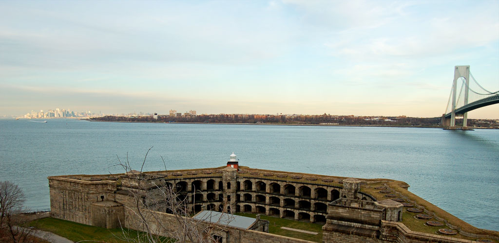
The race begins at Fort Wadsworth on the Staten Island side of the bridge. This is one of the only points in the five boroughs where the entire course starts on a single piece of land, and the first two miles run across the bridge itself. The Start Line area is heavily secured — no private vehicles are permitted anywhere near Fort Wadsworth on race morning, and the only way in is by marathon-designated shuttle, the Staten Island Ferry to St. George Terminal, or on foot.
Runner access: Runners are waved into the Start Village by wave and bib number. The village opens roughly 5:00 AM; athletes should plan to arrive at least 90 minutes before their wave start. Bag check, restrooms, and gear storage are provided inside the secured perimeter.
Spectator access to the Start Line: Spectators can watch the start from the Fort Wadsworth perimeter and the Fort Hamilton area on the Brooklyn side, but the bridge approaches themselves are closed to pedestrians except in designated race zones. The best public viewing is from the shoreline parks at either end, not from the bridge roadway.
📸 Spectator Vantage Points
Fort Wadsworth & Gateway National Recreation Area (Staten Island)
The most accessible spectator area is the Gateway National Recreation Area — Fort Wadsworth, just below the bridge's Staten Island tower. Parking fills by early morning, so arrive by 6:00 AM or take the Staten Island Ferry plus a short walk or taxi. From here you can see the start waves assemble and watch runners cross the lower level. See our full Staten Island attractions guide for nearby sights to pair with a race-day visit.
Shore Road Park & John Paul Jones Park (Brooklyn, Bay Ridge)
On the Brooklyn side, Shore Road Park and the adjacent John Paul Jones Park offer unobstructed views of the bridge's Brooklyn tower and the runners' exit from the bridge. These are free, open parks with wide sidewalks — ideal for watching Mile 3 as runners come off the bridge and turn toward Fourth Avenue. Parking is tight; the R train to Bay Ridge–95th Street is the easiest approach.
Fort Hamilton & Gravesend (Brooklyn)
The Fort Hamilton Parkway corridor and the Gravesend neighborhood are where the race leaves the bridge area and heads north. Spectators line the sidewalks along 4th Avenue from about 65th Street onward; this is where the energy peaks as the full field is on the road together.
🎒 Race-Day Planning: What to Bring & When to Arrive
Bring: warm layers (it's typically 35–50°F at the start and can feel colder near the harbor), a reusable water bottle, snacks, a portable chair or blanket for the start-line wait, and a fully charged phone. Restrooms are available at the Start Village and at the shoreline parks, but lines are long — go early.
Arrive: For the 7:00 AM-ish start waves, be on Staten Island by 6:00 AM. For the best bridge-viewing spots at either end, arrive by 5:30 AM to claim a spot. The first waves cross the lower level roughly between 7:00 AM and 8:30 AM; the final runners clear the bridge around midday.
Toll reminder: The Verrazzano carries split tolling in both directions — $7.46 per passenger car with NY E-ZPass, $12.03 Tolls by Mail. Staten Island residents enrolled in the SIR rebate program pay $2.75. You will not cross the bridge itself on race day, but the Goethals and Outerbridge detours use the same toll structure. See our complete toll guide for full vehicle-rate tables, or the 2026–2027 toll rates guide for a one-table answer.
📋 Quick Summary
- Date: Sunday, November 1, 2026 · 50,000+ runners, 50th anniversary edition
- Bridge closed to vehicles: upper level from 11:00 PM Sat Oct 31; lower level from 6:30 AM Sun Nov 1; reopens ~3:00 PM
- Only direct SI–Brooklyn route: closed — detour via Goethals Bridge or Outerbridge Crossing (budget +60–90 min)
- Bus: ~40 MTA routes rerouted; no direct bus across the bridge
- Best free crossing: Staten Island Ferry (25 min each way, foot passengers and bikes only, no Brooklyn service)
- Start: Fort Wadsworth, Staten Island · Finish: Central Park, Manhattan
- Best spectator views: Fort Wadsworth (SI), Shore Road Park & John Paul Jones Park (Brooklyn), Fort Hamilton Parkway
Always confirm the final closure schedule on mta.info/agency/bridges-and-tunnels and the NYRR official marathon page in the week before the race — times shift as race logistics finalize.